Difference between revisions of "Puwera"
m (→Summary of Results) |
m (→Archaeologists) |
||
| Line 49: | Line 49: | ||
* Raylene, Tutor | * Raylene, Tutor | ||
| − | + | Survey Team: | |
* [[ThorneBen|Ben Thorne]] | * [[ThorneBen|Ben Thorne]] | ||
* [[SutherlandColin|Colin Sutherland]] | * [[SutherlandColin|Colin Sutherland]] | ||
Revision as of 19:29, 23 February 2008

Excavation of a prehistoric Maori habitation site (and a subsidiary site) south of Whangarei.
Contents
Location
South of Whangarei
Excavation carried out in February 2008 as a joint project between Clough & Associates Ltd and the Department of Anthropology, University of Auckland Field School.

Summary of Results
The Ngako valley head is thus a small discrete archaeological landscape, containing the physical remains of a prehistoric social/political system. If, as seems likely, there was no pa on the adjacent Mt. Tikorangi, then this is not a satellite settlement, but rather a system in its own right, although probably associated with a larger stronghold some distance away in the surrounding region to which the population could retreat in times of large scale warfare.
The original archaeological survey by Simon Best located at least 14 prehistoric sites in the watershed, and it is certain that more are present, which have either been missed or have no visible surface detail. Caches of agricultural tools in the swamps are likely to be in the latter category. The sites cover a range of types, from a small pa to single pits and/or terraces. The topography of the area has resulted in the larger complexes being on the knolls on the west and north slopes of the valley head, with the sites spread along the more gentle north-facing slope south of the Ngako in general being much smaller. Of the latter however site QO7/1101 however is extensive, and is also the central site on the south side. This may be the equivalent to 1 of the more discrete ridge sites on the north side, with the smaller sites around it at some distance due to the topography.
See the Introductory Video (Windows only) by Dr Marianne Turner:
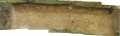
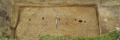
Excavation of Q07/1092 revealed a number of large storage pits, smaller pits, possible house terraces. The storage pits include a long skinny pit - approximately 9m x 2.5m - along with other wider pits. Drains around the edges of the pits are visible with central lines of postholes.

Week 1 Plan
Feature 1
Feature 2

Research Strategy
The archaeological investigations aims to:
- Establish the full extent of the surviving archaeological remains of sites Q05/1091, 1092 and 1103.
- Gain additional information regarding the functional nature of occupation on the basis of structural remains and evidence of lifestyle revealed by associated artefacts and analysis of midden deposits.
- Retrieve all possible information relating to the environmental context of the site(s) and the age of the deposits
- Retrieve samples for phytolith analysis to investigate the presence of early agriculture.
- Integrate the information recovered from the investigation with the results of earlier investigations in the Whangarei area.
- Add to existing knowledge of the material remains/artefact assemblages of recorded settlement sites in the Whangarei area.
- Produce a study of the archaeology of the pre-European settlement of the Ngako Creek area of Whangarei set in the broader regional context
Archaeologists
Directors
Supervisors
Clough:
University of Auckland:
- Rod Wallace
- Raylene, Tutor
Survey Team:
Students/Volunteers

Artefacts
Artefacts recovered include obsidian flakes, a small greenstone chisel, a reworked adze.
Chronology
Not yet known.