Difference between revisions of "Duck Creek Dams - Visit"
(→Location:) |
|||
| Line 23: | Line 23: | ||
-36.81887, 174.725554, Lower dam | -36.81887, 174.725554, Lower dam | ||
</googlemap> | </googlemap> | ||
| + | |||
| + | {{#display_map: | ||
| + | -36.84846, 174.763332~Auckland, New Zealand; | ||
| + | -36.819712, 174.72079~Upper Dam; | ||
| + | -36.81887, 174.725554~ower dam; | ||
| + | | height= 400px | ||
| + | | width= 600px | ||
| + | | type=satellite | ||
| + | | zoom=12 | ||
| + | }} | ||
| + | |||
| + | [[Category:Auckland]] | ||
| + | |||
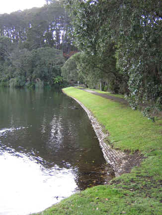
[[File:Chelsea.jpg|framed|The brick faced lower dam]] | [[File:Chelsea.jpg|framed|The brick faced lower dam]] | ||
| + | |||
| + | [[Category:Auckland_Sites_to_Visit]] | ||
== What: == | == What: == | ||
Revision as of 20:42, 4 August 2013
Contents
Duck Creek Dams
Location:
| SITE TO VISIT | |
|---|---|
| Duck Creek Dams | |
| - | |
| | |
| | |
| Ethnicity: | European |
| Site type: | Industrial |
| Where: | North Shore 20 minutes from the city centre. |
| How to get there: | Bus (Check Rideline) or taxi. Turn down Colonial Road to Chelsea Sugar Refinery from Mokoia Rd, Highbury. |
| How Long to allow: | 1 hr. |
| Disclaimer | |
<googlemap lat="-36.818561" lon="174.724073" zoom="16"> -36.84846, 174.763332, Auckland, New Zealand -36.819712, 174.72079, Upper Dam -36.81887, 174.725554, Lower dam </googlemap>
Loading map...
What:
Earth dams on Duck Creek built to supply an adjacent sugar works which is still operating, but not using the dams. The lower dam is brick faced internally, and basalt faced on the sea side. Now in a park.
Web Info:
http://www.chelsea.co.nz/net/sugar-history/default.aspx
http://www.historic.org.nz/TheRegister/RegisterSearch/RegisterResults.aspx?RID=7792

