Clutha Valley Archaeological Project
Contents
Clutha Valley Archaeological Project
What
The project was occasioned by the construction of the Ckyde Dam on the Clutha River. The dam was one of three projected for the project but was the only one to have been built. Surveys over 1975-77 in the river valley by Higham and Mason and a second one by Newman revealed a wealth of archaeological sites in the area. The project was jointly commissioned by the Ministry of Works and the NZ Electricity Department and was initially programmed for five years but this expanded to ten. It ran from to 1977 to 1987. Neville Ritchie was engaged by NZHPT to lead the project and seconded to MWD Cromwell.
The project looked at some Maori sites but the greater part of the evidence was historic from the early mining period. As a project concentrating on historical archaeology it was a pioneering one in New Zealand. The project started in a field where there had only been amateurs working previously, many just collectors, so it had to develop methods and resources appropriate to the area and the materials found, virtually from scratch. Many of the sites proved to be the remnants of the occupation of the area by Chinese miners. The project received international attention for its achievements particularity in the field of studies of the overseas Chinese.
The scope of the project included the whole river basin, not just the area affected by the dams and lakes.
As the only archaeologist in the area Ritchie had other calls on his attention and a good number of small investigations were undertaken "-off project". Public relations was also a major aspect of the project and very important to the project funders.
The project also looked back at the previous power project in the area, Roxburgh, and surveyed the remaining sites along its lake that had not been flooded.
One outgrowth of the project was the ongoing attention to goldfields heritage. Many sites are now preserved and visitor attractions exist at many. Once titled the Otago Goldfields Park this name has since gone out of official favour. The Department of Conservation is one of the leading location managers in regard to sites. Another outcomes was the number of participating archaeologists who went on from early career involvement in the project to become leading professionals in cultural resource management and archaeology.
Director
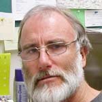
Neville Ritchie - who was resident for the whole project.Sites Investigated
Queens Ferry
Rockfall Shelter II
Park Burn
Dart Bridge
Hanging Rock Shelter\Riverside Chinese Shelter
Cromwell Chinatown
Arrowtown Chinese Settlement
Phoenix Quartz Mining dynamo site
Halfway House Hotel
Platform Shelter
Flax Grove shelter
Willows Hut site
Horseshoe Bend Hut site
(Only Clutha Valley sites are included)
Participating Archaeologists
Charles Higham
Graeme Mason
A P Harrison
Sheridan Easdale
Athol Anderson
Debbie Foster
Stuart Bedford
Alexy Simmons
Outputs
Ritchie's 2016 publication [1] is a comprehensive retrospective on the project.
Many publications resulted. The bibliography below is drawn from Ritchie's paper.
References
- ↑ Central Otago Goldfields Archaeology. 2016 in Rushing for Gold, Life and Commerce on the Goldfields of New Zealand and Australia. Eds Lloyd Carpenter and Lyndon Fraser Otago University Press: 284-299.
