File:Composite image of tunnel systems.jpg
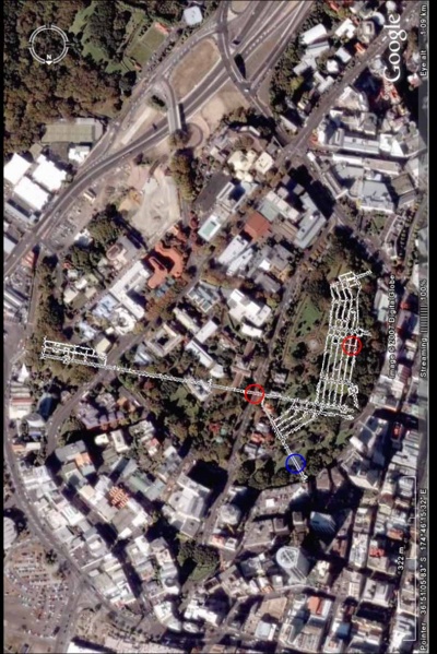
Revision as of 06:21, 23 June 2008 by S.pilkington (talk | contribs) (composite image of tunnel systems, red circles indicating known collapses, blue circle indicating suspected collapse. Cityscape taken from Google Earth, tunnel layout taken from engineers blueprints (sourced from Auckland City Archives), composition const)

Size of this preview: 400 × 599 pixels. Other resolutions: 160 × 240 pixels | 789 × 1,181 pixels.
Original file (789 × 1,181 pixels, file size: 159 KB, MIME type: image/jpeg)
composite image of tunnel systems, red circles indicating known collapses, blue circle indicating suspected collapse. Cityscape taken from Google Earth, tunnel layout taken from engineers blueprints (sourced from Auckland City Archives), composition constructed by Scott Pilkington, November 2007
File history
Click on a date/time to view the file as it appeared at that time.
| Date/Time | Thumbnail | Dimensions | User | Comment | |
|---|---|---|---|---|---|
| current | 06:21, 23 June 2008 |  | 789 × 1,181 (159 KB) | S.pilkington (talk | contribs) | composite image of tunnel systems, red circles indicating known collapses, blue circle indicating suspected collapse. Cityscape taken from Google Earth, tunnel layout taken from engineers blueprints (sourced from Auckland City Archives), composition const |
- You cannot overwrite this file.
File usage
The following page links to this file: