Difference between revisions of "Tapapakanga Pa - Visit"
| Line 20: | Line 20: | ||
</googlemap> | </googlemap> | ||
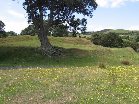
| − | [[File:Tapa.jpg|framed|The pa]] | + | [[File:Tapa.jpg|framed|left|The pa]] |
== What: == | == What: == | ||
Revision as of 14:14, 9 January 2011
Tapapakanga Pa
| SITE TO VISIT | |
|---|---|
| Pa at Tapapakanga Pa | |
| - | |
| | |

| |
| Ethnicity: | Maori |
| Site type: | Fortification |
| Where: | Tapapakanga Park, Firth of Thames |
| How to get there: | Stop at the main carpark, go down to the beach and turn right on to the coastal track, a couple of hundred meteres along there is a branch up the hill to the right which leads directly to the pa.Drive along the Rangikapiti Point road. There is an obvious walking track up to the pa. |
| How Long to allow: | An hour |
| Disclaimer | |
Location:
<googlemap lat="-36.974718" lon="175.256953" zoom="16"> -36.975901, 175.258477, Pa at Tapapakanga </googlemap>
What:
Maori fortification - pa, framed in glorious old pohutukawa trees.
Web Info:
http://www.arc.govt.nz/albany/main/parks/our-parks/parks-in-the-region/tapapakanga/
Photosynth:
Photosynth taken 9 January 2011.
What else to do there:
Visit the Ashby colonial house by the car park. There is a heritage trail at the park that takes in more sites.
