Difference between revisions of "Otatara Pa - Visit"
| Line 11: | Line 11: | ||
| site_type = Pa | | site_type = Pa | ||
| where = In a reserve southwest of Taradale. There is a signposted carpark of Springfield Rd | | where = In a reserve southwest of Taradale. There is a signposted carpark of Springfield Rd | ||
| − | | how_to_get_there = | + | | how_to_get_there = [http://www.hbrc.govt.nz/WhatWeDo/PassengerTransport/BusTimetable/tabid/976/Default.aspx Napier Buses] |
| how_long_to_allow = 2 hrs walking over the site. Reasonable fitness needed | | how_long_to_allow = 2 hrs walking over the site. Reasonable fitness needed | ||
Revision as of 17:18, 7 December 2010
Otatara Pa

|
This page is a Stub |
| Further content needs to be added. For changes please drop a note to the webmaster. |
| SITE TO VISIT | |
|---|---|
| Otatara | |
| ' | |
| | |

| |
| Ethnicity: | Maori |
| Site type: | Pa |
| Where: | In a reserve southwest of Taradale. There is a signposted carpark of Springfield Rd |
| How to get there: | Napier Buses |
| How Long to allow: | 2 hrs walking over the site. Reasonable fitness needed |
| Disclaimer | |
Location:
<googlemap lat="-39.548596" lon="176.829672" zoom="14"> -39.492844, 176.912018, Napier, New Zealand -39.548133, 176.828556, Otatara Pa </googlemap>
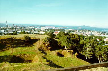
What: Prehistoric Maori fortification reputedly the largest in New Zealand. There are clear defences, much terracing and kumara storage pits. There is some on-site interpretation, and a representation of former palisading built on a quarry damaged part of the site.
What else to do there:
Great views over the plain to Napier, Hastings and beyond to Hawkes Bay. Museum in Napier. Wineries in the district.
Web Info: http://www.arc.govt.nz/environment/volcanoes-of-auckland/mt-eden.cfm
Photosynth Views
