|
|
| Line 18: |
Line 18: |
| | }} | | }} |
| | | | |
| − | <googlemap lat="-36.814593" lon="174.806085" zoom="17">
| |
| − | -36.81516, 174.805763, Fort Takapuna
| |
| − | </googlemap>
| |
| | | | |
| | {{#display_map: | | {{#display_map: |
| Line 27: |
Line 24: |
| | | width= 600px | | | width= 600px |
| | | type=satellite | | | type=satellite |
| − | | zoom=15 | + | | zoom=17 |
| | }} | | }} |
| | [[Category:Museum]] | | [[Category:Museum]] |
Revision as of 20:44, 4 August 2013
Fort Takapuna
Location:
| SITE TO VISIT
|
| Fort Takapuna
|
| -
|

|

|
| Ethnicity:
|
European
|
| Site type:
|
Harbour defences
|
| Where:
|
North Shore - 30 minutes from the city centre. Walkable from the ferry at Devonport.
|
| How to get there:
|
Narrow Neck Beach then walk 300 m south along the cliff edge.
|
| How Long to allow:
|
1 Hr
|
| Disclaimer
|
Loading map...
{"minzoom":false,"maxzoom":false,"mappingservice":"leaflet","width":"600px","height":"400px","centre":false,"title":"","label":"","icon":"","visitedicon":"","lines":[],"polygons":[],"circles":[],"rectangles":[],"wmsoverlay":false,"copycoords":false,"static":false,"zoom":17,"defzoom":14,"layers":["OpenStreetMap"],"overlaylayers":[],"resizable":false,"enablefullscreen":false,"scrollwheelzoom":true,"markercluster":false,"clustermaxzoom":20,"clusterzoomonclick":true,"clustermaxradius":80,"clusterspiderfy":true,"locations":[{"text":"\u003Cb\u003E\u003Cdiv class=\"mw-parser-output\"\u003E\u003Cpre\u003EFort Takapuna\n\u003C/pre\u003E\u003C/div\u003E\u003C/b\u003E\u003Chr /\u003E\u003Cdiv class=\"mw-parser-output\"\u003E\u003C/div\u003E","title":"Fort Takapuna\n","link":"","lat":-36.81515999999999877445588936097919940948486328125,"lon":174.80576300000001310763764195144176483154296875,"icon":""}],"imageoverlays":null}

The Victorian bunkers
What:
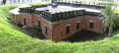
Harbour fortifications built from the 19th century Russian scare to the second world war. Disappearing gun pits, tunnels to magazines. Good interpretation.
Web Info
http://www.doc.govt.nz/parks-and-recreation/places-to-visit/auckland/auckland-area/fort-takapuna-historic-reserve/
http://www.doc.govt.nz/parks-and-recreation/tracks-and-walks/auckland/auckland-area/fort-takapuna-historic-walk/
http://www.doc.govt.nz/conservation/historic/by-region/auckland/auckland-area/fort-takapuna-historic-reserve/
4d Canvas have produced a virtual reality model of the defences - see http://www.4dcanvas.com/4dcanvas/portfolio.html


