Difference between revisions of "Okaihau Railway Tunnel - Visit"
(→Location:) |
|||
| (One intermediate revision by the same user not shown) | |||
| Line 18: | Line 18: | ||
}} | }} | ||
| − | + | {{#display_map: | |
| − | -35.320728, 173.770344 | + | -35.320728, 173.770344~ Railway Tunnel; |
| − | + | | height= 400px | |
| + | | width= 600px | ||
| + | | type=satellite | ||
| + | | zoom=17 | ||
| + | }} | ||
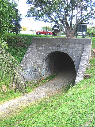
[[File:Okaihau.jpg|framed|The south portal]] | [[File:Okaihau.jpg|framed|The south portal]] | ||
Latest revision as of 21:33, 4 August 2013
Okaihau Railway Tunnel
Location:
| SITE TO VISIT | |
|---|---|
| Okaihau Railway Tunnel | |
| - | |
| | |

| |
| Ethnicity: | European |
| Site type: | Railway Heritage |
| Where: | Okaihau, inland Bay of Islands |
| How to get there: | Under the main road into Okaihau - within Two Punga Park. |
| How Long to allow: | 15 minutes |
| Disclaimer | |
Loading map...
What:
Railway tunnel of 1926 on an abandoned line, now part of a cycleway. The tunnel is short so no lighting is needed to visit.
Okaihau was the northern end of New Zealand railways from 1923 to 1987. The rail was intended to extend to Kaitaia but only short-lived attempts were made to complete it. The railway station was on the north side of the tunnel.
Web Info:
http://www.kaikohe.co.nz/Cycleway_Project.cfm?NewsID=40&NewsCatID=5&disp=detail
What else to do there:
The Waimate North Mission (NZHPT) is not far away.

