Difference between revisions of "Musick Point Pa - Visit"
(→Panorama) |
(→Location:) |
||
| Line 22: | Line 22: | ||
-36.847689, 174.9014, Musick Point Pa | -36.847689, 174.9014, Musick Point Pa | ||
</googlemap> | </googlemap> | ||
| + | |||
| + | {{#display_map: | ||
| + | -36.847689, 174.9014~ Musick Point Pa; | ||
| + | | height= 400px | ||
| + | | width= 600px | ||
| + | | type=satellite | ||
| + | | zoom=10 | ||
| + | }} | ||
{| | {| | ||
Revision as of 20:55, 4 August 2013
Musick Point Pa
| SITE TO VISIT | |
|---|---|
| Musick Point Pa | |
| Te Waiarohia | |
| | |

| |
| Ethnicity: | Maori |
| Site type: | Pa - fortification |
| Where: | Eastern side of the Tamaki Eastury |
| How to get there: | 30 minutes from the city |
| How Long to allow: | 1 Hour |
| Disclaimer | |
Location:
<googlemap lat="-36.843156" lon="174.900198" zoom="14"> -36.847689, 174.9014, Musick Point Pa </googlemap>
Loading map...
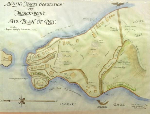
What:Large headland pa - highly modified but with still some evidence remaining.The site is named after pioneer Pacific aviator Ed Musick. |
Panorama
Panorama of the small pa the the northern tip of the site showing pits and terraces. |
Web Info:
http://en.wikipedia.org/wiki/Musick_Point
What else to do there:
Visit the Art Deco Aeradio Station building.
