Difference between revisions of "Ambury Regional Park"
(→Archaeology) |
(→Archaeology) |
||
| Line 21: | Line 21: | ||
[[Image:MaoriStones.jpg]] | [[Image:MaoriStones.jpg]] | ||
| + | |||
| + | |||
| + | |||
Photog: unknown [http://www.nzetc.org/tm/scholarly/tei-BesMaor-c6-1.html Maori History] | Photog: unknown [http://www.nzetc.org/tm/scholarly/tei-BesMaor-c6-1.html Maori History] | ||
| + | |||
| + | |||
| + | ---- | ||
| + | |||
| + | == History == | ||
| + | Nearby Mangere Mountain was once the site of large fortified Māori pa and the area now known as Ambury Regional Park was used by Māori for gardening. Mangere Mountain erupted approximately 18,000 years ago and the park sits atop a lava field made fertile by ash from the volcano. | ||
| + | |||
| + | The area also provided easy access to seafood (kaimoana) and canoe launching sites for the various iwi (including Wia-o-Hua and Ngāti Whatua) who lived in and around the pa. The park and the Otuataua Stonefields to the south of it are the only places in Auckland where Māori stone structures remain on public land. Stone mounds at Ambury mark pre-European gardening sites. | ||
| + | |||
| + | The dry stone walls bordering the drive into the park date from the mid 1800s when farmers from Cornwall and Scotland built them. Volunteers have worked to restore the walls. You can also see the remains of a windmill and wells that were part of the Ambury Milk company. | ||
| + | |||
| + | |||
| + | |||
| + | [[Image:MangereMountain.jpg]] | ||
| + | |||
| + | |||
| + | Photo: [http://www.mangere-bridge.co.nz/intro.html Mangere Bridge Village] | ||
Revision as of 10:45, 22 February 2010
Contents
Location
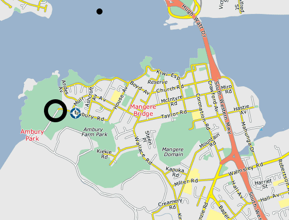
Ambury Regional Park is located just 15 kilometers from Central Auckland and rests on the ash-covered lava flow from Mangere Mountain.

Summary
Nearby Mangere Mountain was once the site of large fortified Māori pa and the area now known as Ambury Regional Park was used by Māori for gardening. Mangere Mountain erupted approximately 18,000 years ago and the park sits atop a lava field made fertile by ash from the volcano. The Archaeological record left behind is astounding and, for the most part, can be viewed by the public. In fact, Ambury Regional Park is the only place where publicly owned Maori Rock Art can be found.
Archaeology
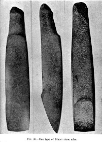
In 1981 over 95 separate archaeological sites were recorded. These mostly included stone and midden piles, but some wall structres and borders can be discerned. The most intact group of sites is found in the north eastern region of the park. Stone mounds and garden walls are distinctive features, but groupings of Archaeological remains can be found throughout the coastline. It is said that the archaeological remains are in such quantity that rabbits are constantly unearthing new midden.
Photog: unknown Maori History
History
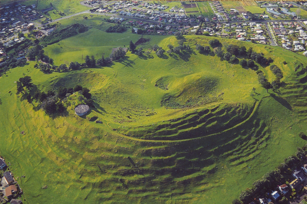
Nearby Mangere Mountain was once the site of large fortified Māori pa and the area now known as Ambury Regional Park was used by Māori for gardening. Mangere Mountain erupted approximately 18,000 years ago and the park sits atop a lava field made fertile by ash from the volcano.
The area also provided easy access to seafood (kaimoana) and canoe launching sites for the various iwi (including Wia-o-Hua and Ngāti Whatua) who lived in and around the pa. The park and the Otuataua Stonefields to the south of it are the only places in Auckland where Māori stone structures remain on public land. Stone mounds at Ambury mark pre-European gardening sites.
The dry stone walls bordering the drive into the park date from the mid 1800s when farmers from Cornwall and Scotland built them. Volunteers have worked to restore the walls. You can also see the remains of a windmill and wells that were part of the Ambury Milk company.
Photo: Mangere Bridge Village

