Difference between revisions of "HobsonSt152"
S.pilkington (talk | contribs) |
|||
| (10 intermediate revisions by 2 users not shown) | |||
| Line 3: | Line 3: | ||
The bulk of excavated features confirm the 1908 plan and the layout of the 1907 shops along Hobson St. The excavation results were also plotted against the 1882 Hickson map showing the 19th century structures on the property. This shows that no 19th century remains were recovered from the recorded locations of the buildings, although remnants of associated structures (a field drain, rubbish pit/cesspit and the bases of some small square foundations close to the small building on the eastern boundary) were located. The smaller building at the eastern end of the property may have been between Trenches 3 and 5, and it is possible that one or more of the small square foundations may relate to this building. | The bulk of excavated features confirm the 1908 plan and the layout of the 1907 shops along Hobson St. The excavation results were also plotted against the 1882 Hickson map showing the 19th century structures on the property. This shows that no 19th century remains were recovered from the recorded locations of the buildings, although remnants of associated structures (a field drain, rubbish pit/cesspit and the bases of some small square foundations close to the small building on the eastern boundary) were located. The smaller building at the eastern end of the property may have been between Trenches 3 and 5, and it is possible that one or more of the small square foundations may relate to this building. | ||
---- | ---- | ||
| − | + | ==Location and Date== | |
{| width="100%" | {| width="100%" | ||
| | | | ||
* 152 Hobson St, Downtown Auckland. New Zealand | * 152 Hobson St, Downtown Auckland. New Zealand | ||
* Excavations in 2006 | * Excavations in 2006 | ||
| − | |<googlemap lat="-36.849732" lon="174.761088" width="200" height="200" selector="no" controls=" | + | |<googlemap lat="-36.849732" lon="174.761088" zoom="15" width="200" height="200" selector="no" controls="small"></googlemap> |
|} | |} | ||
| − | + | ||
| − | {| | + | ==Type== |
| − | Late 19th Century, Early 20th Century Excavations | + | {| width="100%" |
| − | |{{#ev:youtube|HaB9O21IIAA| | + | |Late 19th Century, Early 20th Century Excavations |
| + | |{{#ev:youtube|HaB9O21IIAA|200}} | ||
|} | |} | ||
| − | + | ||
| + | ==Excavators== | ||
'''Archaeology Team Responsibilities''' | '''Archaeology Team Responsibilities''' | ||
* [[BarryBaquie|Barry Baquié]] Field Supervisor | * [[BarryBaquie|Barry Baquié]] Field Supervisor | ||
| − | * [[ | + | * [[Bickler Simon|Simon Bickler]] Director |
* [[RodClough|Rod Clough]] Director | * [[RodClough|Rod Clough]] Director | ||
| − | * [[JenniferLow|Jennifer Low]] Field | + | * [[JenniferLow|Jennifer Low]] Field Archaeologist, Artefacts |
| + | * [[Best Simon|Simon Best]] Field Archaeologist | ||
* Susan Yoffee Historical Research | * Susan Yoffee Historical Research | ||
---- | ---- | ||
| − | + | ||
| + | ==Artefacts== | ||
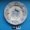
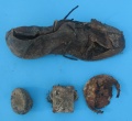
Collection of artefacts from the fill. | Collection of artefacts from the fill. | ||
| + | <gallery> | ||
| + | Image:hobsonst152_plate.jpg | ||
| + | Image:hobsonst152_bottles.jpg | ||
| + | Image:hobsonst152_shoe.jpg | ||
| + | </gallery> | ||
| + | ---- | ||
| − | + | ==Publications== | |
| − | |||
Excavation Report: | Excavation Report: | ||
* Available from [http://www.clough.co.nz/resources.htm Clough & Associates Ltd Website] | * Available from [http://www.clough.co.nz/resources.htm Clough & Associates Ltd Website] | ||
---- | ---- | ||
| − | + | ==Other== | |
View video at YouTube: [http://www.youtube.com/watch?v=HaB9O21IIAA Excavation of the well] | View video at YouTube: [http://www.youtube.com/watch?v=HaB9O21IIAA Excavation of the well] | ||
---- | ---- | ||
| − | [[Category: Historic | + | [[Category: Excavations]] |
| + | [[Category: Historic]] | ||
| + | [[Category: Auckland]] | ||
[[Category: New Zealand]] | [[Category: New Zealand]] | ||
| − | [[Category: | + | [[Category: 2006]] |
Latest revision as of 02:15, 28 May 2009
Summary
The bulk of excavated features confirm the 1908 plan and the layout of the 1907 shops along Hobson St. The excavation results were also plotted against the 1882 Hickson map showing the 19th century structures on the property. This shows that no 19th century remains were recovered from the recorded locations of the buildings, although remnants of associated structures (a field drain, rubbish pit/cesspit and the bases of some small square foundations close to the small building on the eastern boundary) were located. The smaller building at the eastern end of the property may have been between Trenches 3 and 5, and it is possible that one or more of the small square foundations may relate to this building.
Location and Date
|
<googlemap lat="-36.849732" lon="174.761088" zoom="15" width="200" height="200" selector="no" controls="small"></googlemap> |
Type
| Late 19th Century, Early 20th Century Excavations |
Excavators
Archaeology Team Responsibilities
- Barry Baquié Field Supervisor
- Simon Bickler Director
- Rod Clough Director
- Jennifer Low Field Archaeologist, Artefacts
- Simon Best Field Archaeologist
- Susan Yoffee Historical Research
Artefacts
Collection of artefacts from the fill.
Publications
Excavation Report:
- Available from Clough & Associates Ltd Website
Other
View video at YouTube: Excavation of the well


